
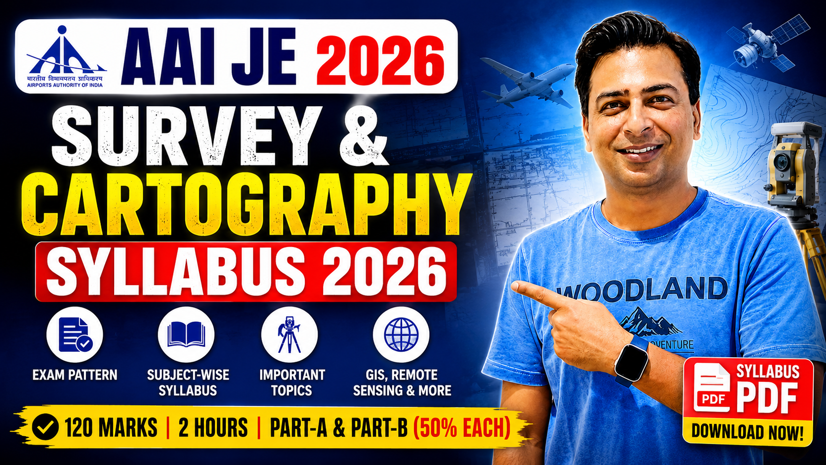
AAI Junior Executive Survey and Cartography Syllabus 2026, Exam Pattern & PDF
Download the latest AAI Junior Executive Survey and Cartography Syllabus 2026 PDF and check the complete subject-wise syllabus, latest exam pattern, marks distribution and important topics for the Computer Based Test (CBT).
The official syllabus for AAI Junior Executive (Survey & Cartography) includes General Knowledge, General Intelligence, General Aptitude, English and subjects related to the educational qualifications, including Civil Engineering, Geography, Remote Sensing & GIS, Geo-informatics and Geomatics.
AAI Junior Executive Survey and Cartography Syllabus 2026
📌 AAI JE Survey and Cartography Syllabus Highlights
- ✔ Recruitment Authority : Airports Authority of India (AAI)
- ✔ Post Name : Junior Executive (Survey & Cartography)
- ✔ Advertisement No. : 12/2026/CHQ/DR-CBT
- ✔ Examination Mode : Computer Based Test (CBT)
- ✔ Total Marks : 120
- ✔ Duration : 2 Hours
- ✔ Part-A Weightage : 50%
- ✔ Part-B Weightage : 50%
- ✔ Technical / Qualification-Based Subjects : 50%
AAI Junior Executive Survey and Cartography Syllabus 2026
Looking for the latest AAI Junior Executive Survey and Cartography Syllabus 2026? You are at the right place. On this page, you can check the official syllabus, examination pattern, marks distribution and complete subject-wise topics for the AAI JE Survey & Cartography Examination 2026.
The official AAI JE Survey and Cartography Syllabus is divided into two parts. Part-A covers General Knowledge, General Intelligence, General Aptitude and English etc., while Part-B covers subjects related to the prescribed educational qualifications. Both parts carry 50% weightage.
The technical portion of the AAI JE Survey Cartography Syllabus 2026 is extensive and includes Civil Engineering, Geography, Remote Sensing and GIS, Geo-informatics and Geomatics. Candidates should therefore prepare both the general aptitude section and the technical subjects systematically.
📢 Important Note About the Syllabus
The subject-wise topics given below are taken from the official AAI syllabus for Junior Executive (Survey & Cartography) provided in Advertisement No. 12/2026/CHQ/DR-CBT. Candidates should refer to the official syllabus PDF while planning their preparation.
📚 Subject-wise AAI JE Survey and Cartography Syllabus
AAI JE Survey and Cartography Exam Pattern 2026
Before starting preparation, candidates should understand the official examination pattern. According to the official syllabus, the AAI Junior Executive (Survey & Cartography) Computer Based Test carries 120 marks and has a duration of two hours.
The examination syllabus is divided into Part-A and Part-B. Part-A contains General Knowledge, General Intelligence, General Aptitude, English etc., while Part-B contains questions on subjects relating to the educational qualifications. Each part carries 50% weightage.
| Part | Subjects | Weightage |
|---|---|---|
| Part-A | General Knowledge, General Intelligence, General Aptitude, English etc. | 50% |
| Part-B | Questions on subjects relating to Educational Qualifications | 50% |
| Total | 100% | |
📊 Quick Exam Pattern
- ✔ Total Marks : 120
- ✔ Examination Duration : 2 Hours
- ✔ Part-A : 50% Weightage
- ✔ Part-B : 50% Weightage
- ✔ Part-B focuses on qualification-related technical subjects.
📘 Part-A Syllabus – General Subjects
Part-A of the AAI Junior Executive Survey and Cartography Syllabus 2026 carries 50% weightage. According to the official syllabus, this part includes the following areas:
- General Knowledge
- General Intelligence
- General Aptitude
- English etc.
Candidates should prepare the general section along with the technical portion because Part-A contributes 50% weightage to the examination.
📚 Part-B – Technical / Qualification-Based Syllabus
Part-B carries 50% weightage in the official AAI JE Survey and Cartography Syllabus 2026. This part contains questions on subjects relating to the educational qualifications.
The official syllabus covers a broad range of subjects including Basic Sciences & Civil Engineering, Geography, Remote Sensing and GIS, Geo-informatics and Geomatics.
🎯 AAI JE & Manager Non-Tech Course – Part-A
If you are preparing for AAI Junior Executive Operations, Finance, Law, HR or other AAI Non-Tech/Manager posts, our Non-Tech Course covers the major Part-A subjects including Quantitative Aptitude, Reasoning, General Knowledge and English.

Course Features
- ✅ Useful for AAI JE & Manager Posts
- ✅ Quantitative Aptitude
- ✅ Reasoning
- ✅ General Knowledge
- ✅ English
- ✅ Recorded Video Lectures
- ✅ 75 Mock Tests – Free
- ✅ Web & App Access
Course Price: ₹1199/- (Use Coupon Code- MANAGER100)
🏗️ Basic Sciences & Civil Engineering Syllabus
The Basic Sciences and Civil Engineering section is an important component of the technical portion of the AAI JE Survey Cartography Syllabus. The official syllabus covers the following topics:
Mathematics & Basic Sciences
- Calculus
- Linear Algebra
- Differential Equations
- General Chemistry
- Physics
- Introductory Biology
Engineering Mechanics & Computer Science
- Engineering Mechanics
- Computer Science
Structural Engineering
- Mechanics of Solids
- Structural Analysis I & II
- Civil Engineering Materials
- RC Design
- Steel Design
- Construction Practices
- Construction Management
Geotechnical Engineering & Geology
- Engineering Geology
- Soil Mechanics
- Geotechnical Engineering
Water Resources & Environment
- Mechanics of Fluids
- Environmental Engineering
- Hydraulics
- Engineering Hydrology
Surveying & Transportation
- Fundamentals and Elements of Surveying
- Surveying Instruments
- Measurement Techniques
- Chain and Compass Surveying
- Plane Table Surveying
- Levelling and Contouring
- Theodolite Surveying
- Engineering Surveying
- UAV/Drone Surveying
- Cadastral and Land Surveying
- Hydrographic Surveying
- Introduction to Transportation Engineering
🌍 Geography Syllabus
Geography forms another major component of the AAI Junior Executive Survey and Cartography Syllabus 2026. The official syllabus includes physical geography, cartography, GIS, field studies and environmental management-related topics.
Geomorphology
- Earth Surface Processes
- Fluvial Mechanics
- Landform Evolution
Climatology & Oceanography
- Atmospheric Circulation
- Climate Change Impacts
- Marine Ecosystems
Geographical Thought
- History of Geographical Thought
- Paradigm Shifts in Spatial Philosophy
Quantitative Techniques & Cartography
- Statistical Analysis
- Spatial Data Modeling
- Map Projections
Remote Sensing & GIS
- Digital Image Processing
- Spatial Querying
- Terrain Mapping
Biogeography & Soil Science
- Ecosystem Dynamics
- Pedological Studies
Research Methodology
- Scientific Methods
- Hypothesis Formulation
- Data Collection Techniques
Practical & Field Studies
- Geomorphic Fieldwork
- Socio-Economic Fieldwork
Advanced GIS & Spatial Modeling
- Predictive Modeling
- Network Analysis
- Spatial Database Management
Environmental Management & Hazard Studies
- Disaster Risk Reduction
- Watershed Management
- Sustainability
🛰️ Remote Sensing and GIS Syllabus
The Remote Sensing and GIS section is one of the most important areas of the AAI JE Survey and Cartography Syllabus 2026. The official syllabus includes fundamentals, photogrammetry, digital image processing, GIS, spatial analysis, GNSS and advanced remote sensing.
Fundamentals of Remote Sensing
- Principles of Electromagnetic Radiation
- Energy Interactions with Earth's Surface
- Atmosphere, Soil and Vegetation Interactions
- Satellite Orbits
Principles of Photogrammetry
- Aerial Photography
- Stereoscopy
- Digital Photogrammetry
- Measurement of Elevation
- Relief Displacement
Cartography and Map Projections
- Fundamentals of Cartography
- Cartographic Design
- Thematic Cartography
- Coordinate Systems
- Digital Cartography
- Topographical Mapping
Practical Labs
- Stereoscopes
- Visual Image Interpretation
- Downloading Open-Source Satellite Data
- Landsat and Sentinel Data
Digital Image Processing (DIP)
- Geometric Corrections
- Radiometric Calibration
- Image Enhancements
- Spatial Filtering
Geographic Information Systems (GIS)
- Raster Data Models
- Vector Data Models
- Database Management Systems (DBMS)
- Spatial Data Integration
Spatial Analysis
- Interpolation Techniques
- Buffer Analysis
- Overlay Operations
- Surface Modeling
GIS Practical Applications
- Supervised Image Classification
- Unsupervised Image Classification
- Accuracy Assessment
- Thematic Land-Use/Land-Cover Maps
- QGIS
- ArcGIS
- ERDAS Imagine
Advanced Remote Sensing
- LiDAR
- Microwave / Radar
- Thermal Infrared Imaging
- Hyperspectral Imaging
Global Navigation Satellite Systems (GNSS)
- GPS
- Galileo
- IRNSS / NavIC
- Geodetic Surveying
Applications and Modeling
- Urban Planning
- Disaster Management
- Agriculture
- Forestry
- Hydrology
- Environmental Monitoring
Fieldwork & Practical Labs
- GNSS Field Surveys
- Network Analysis
- Web GIS Development
Elective Courses
- Python/R Programming for Geospatial Analysis
- Machine Learning for Remote Sensing
- Advanced Geostatistics
💻 Geo-informatics Syllabus
The official AAI JE Survey Cartography Syllabus PDF also includes a dedicated Geo-informatics section covering GIS, cartography, spatial statistics, programming, photogrammetry and spatial databases.
Principles of Remote Sensing
- Aerial Photography
- Electromagnetic Spectrum
- Satellite Data Acquisition
Geographical Information Systems (GIS)
- Vector and Raster Data Models
- Topology
- Spatial Databases
Cartography & Surveying
- Map Projections
- Scale
- Digital Mapping Techniques
Spatial Statistics & Mathematics
- Quantitative Methods for Spatial Analysis
Programming for GIS
- Basics of Python
- SQL
- R for Spatial Data
Digital Image Processing
- Image Enhancement
- Image Classification
- Radiometric Corrections
- Geometric Corrections
Photogrammetry
- Stereo-3D Modeling
- DEM / DTM Generation
- Laser Scanning
- LiDAR
GNSS / GPS
- Global Navigation Systems
- DGPS
- Location-Based Services
Spatial Database Management
- Managing Large Geospatial Datasets
- Enterprise Architecture
Field Survey Techniques
- Total Station
- DGPS
- Practical Field Surveys
Web GIS & Cloud Computing
- Interactive Maps
- Web Services
- Cloud-Based Spatial Infrastructure
Spatial Modeling & Decision Making
- Predictive Modeling
- Network Analysis
- Multi-Criteria Evaluation
📐 Geomatics Syllabus
Geomatics is another important area covered in the official AAI Junior Executive Survey and Cartography Syllabus 2026. Candidates should pay special attention to advanced surveying, geodesy, photogrammetry, GIS, GNSS and digital cartography.
Topographical Surveying & Mapping
- Advanced Traversing
- Triangulation
- Total Stations
- Modern Surveying Instruments
Introduction to Geodesy
- Earth's Gravity Field
- Coordinate Systems
- Reference Datums
Remote Sensing
- Electromagnetic Spectrum
- Multispectral Sensors
- Microwave Sensors
- Remote Sensing Data Products
Elements of Photogrammetry
- Stereoscopy
- Aerial Cameras
- Digital Elevation Models (DEM)
DBMS & OOPS for GIS
- Database Management Systems
- Object-Oriented Programming Concepts
- Data Modeling
- Spatial Data Structures
Digital Photogrammetry
- Stereo-Plotting
- Feature Extraction
- Orthorectification
Geographical Information System
- Spatial Interpolation
- Network Analysis
- Buffer Operations
- Overlay Operations
- Web GIS
- Cloud GIS
Advanced Geodesy & GNSS
- Satellite Positioning Principles
- GPS
- Error Corrections
- Geodetic Networks
Digital Cartography, Visualization & Web GIS
- Web-Based Spatial Data Dissemination
- Spatial Data Infrastructures
- Spatial Database Management
Advanced Digital Image Processing
- Image Enhancements
- Principal Component Analysis (PCA)
- Classification Algorithms
🎯 AAI JE Survey and Cartography Technical Syllabus – Quick Revision
| Major Area | Important Topics |
|---|---|
| Basic Sciences & Civil Engineering | Mathematics, Physics, Chemistry, Biology, Civil Engineering, Geotechnical Engineering, Hydraulics, Surveying |
| Geography | Geomorphology, Climatology, Oceanography, Cartography, GIS, Biogeography, Research Methodology |
| Remote Sensing & GIS | Remote Sensing, Photogrammetry, DIP, GIS, Spatial Analysis, GNSS, Advanced Remote Sensing |
| Geo-informatics | GIS, Cartography, Programming, Photogrammetry, GNSS, Spatial Databases, Web GIS |
| Geomatics | Surveying, Geodesy, Remote Sensing, Photogrammetry, GIS, GNSS, Digital Cartography |
🚀 Preparation Tips for AAI JE Survey and Cartography Exam 2026
- ✔ First understand the complete AAI Junior Executive Survey and Cartography Syllabus 2026.
- ✔ Divide your preparation into Part-A and Part-B because both carry 50% weightage.
- ✔ Give sufficient time to Surveying, Cartography, GIS, Remote Sensing and Geomatics.
- ✔ Revise important concepts of Civil Engineering and Geography regularly.
- ✔ Practise numerical and conceptual questions from Mathematics, Engineering and spatial analysis topics.
- ✔ Focus on GIS, Remote Sensing, Photogrammetry, GNSS and Digital Cartography.
- ✔ Prepare General Knowledge, General Intelligence, General Aptitude and English along with technical subjects.
- ✔ Make short notes for formulas, definitions, instruments, surveying techniques and GIS concepts.
- ✔ Practise objective-type questions regularly after completing each topic.
📥 Download AAI JE Survey and Cartography Syllabus PDF 2026
Download the latest AAI JE Survey & Cartography Syllabus PDF 2026 and check the official syllabus prescribed for Junior Executive (Survey & Cartography).
The official syllabus covers Part-A and Part-B, with 50% weightage assigned to each part.
📄 Download Official Syllabus PDF⭐ Important Areas to Focus On
- Surveying Instruments & Measurement Techniques
- Levelling & Contouring
- Theodolite Surveying
- UAV / Drone Surveying
- Cadastral & Land Surveying
- Hydrographic Surveying
- Cartography & Map Projections
- Remote Sensing
- GIS & Spatial Analysis
- Digital Image Processing
- Photogrammetry
- GNSS / GPS / NavIC
- Geodesy
- Digital Cartography
- Web GIS & Cloud GIS
- Spatial Modeling
❓ Frequently Asked Questions – AAI Junior Executive Survey and Cartography Syllabus
1. What is the AAI Junior Executive Survey and Cartography Syllabus 2026?
The official AAI Junior Executive Survey and Cartography Syllabus 2026 is divided into Part-A and Part-B. Part-A includes General Knowledge, General Intelligence, General Aptitude, English etc., while Part-B covers subjects related to the educational qualifications.
2. What is the total marks of the AAI JE Survey and Cartography CBT?
According to the official syllabus, the Computer Based Test carries 120 marks.
3. What is the duration of the AAI JE Survey and Cartography examination?
The examination duration is two hours.
4. What is the weightage of Part-A in the AAI JE Survey Cartography Exam?
Part-A carries 50% weightage in the examination.
5. What is the weightage of Part-B in the AAI JE Survey and Cartography Exam?
Part-B also carries 50% weightage and contains questions on subjects relating to the educational qualifications.
6. Which subjects are included in the technical syllabus?
The official syllabus includes Basic Sciences & Civil Engineering, Geography, Remote Sensing and GIS, Geo-informatics and Geomatics.
7. Is Surveying included in the AAI JE Survey and Cartography Syllabus?
Yes. The official syllabus includes Fundamentals and Elements of Surveying, surveying instruments, measurement techniques, chain and compass surveying, plane table surveying, levelling and contouring, theodolite surveying, engineering surveying, UAV/Drone surveying, cadastral and land surveying and hydrographic surveying.
8. Is GIS and Remote Sensing included in the syllabus?
Yes. Remote Sensing and GIS is an important part of the official syllabus and includes digital image processing, spatial analysis, GIS data models, photogrammetry, GNSS, advanced remote sensing and related practical applications.
9. Does the syllabus include Geomatics?
Yes. Geomatics includes topographical surveying and mapping, geodesy, remote sensing, photogrammetry, GIS, GNSS, digital cartography, Web GIS and advanced digital image processing.
10. Where can I download the AAI JE Survey and Cartography Syllabus PDF?
You can download the AAI JE Survey and Cartography Syllabus PDF 2026 from the official AAI recruitment/syllabus notification. The official syllabus PDF should always be referred to for the latest prescribed topics.
🚀 Start Your AAI JE Survey and Cartography 2026 Preparation Today
Understand the official AAI Junior Executive Survey and Cartography Syllabus 2026, divide your preparation between Part-A and Part-B, and focus on Surveying, Cartography, GIS, Remote Sensing, Geomatics, Geography and other qualification-related subjects.
📄 Official AAI JE Survey and Cartography Syllabus
This page has been prepared using the official syllabus for Junior Executive (Survey & Cartography) under Advertisement No. 12/2026/CHQ/DR-CBT. Candidates are advised to refer to the official document for the exact syllabus and weightage.
Official CBT Details: Total Marks – 120 | Duration – Two Hours | Part-A – 50% | Part-B – 50%.